Death Valley Road Trip: Death Valley Itinerary (Day 1)
Now Go See It is reader-supported. When you buy through links on our site, we may earn an affiliate commission.
Death Valley may be the closest you can get to feeling like you’ve been beamed to another planet circling a far-off star in another universe.
Death Valley National Park Two Day Road Trip Itinerary: (Jump To)
Death Valley By Car Itinerary: Day One: LA to Death Valley
Stop One: Father Crowley Point
Stop Two: Stovepipe Wells Ranger Station (Pay fees)
Stop Three: Hike Mosaic Canyon
Stop Four: Climb the Sand Dunes at Mesquite Flat
Stop Five: Scotty’s Castle
Stop Six: Ubehebe Crater
Stop Seven: Salt Creek
About Death Valley National Park
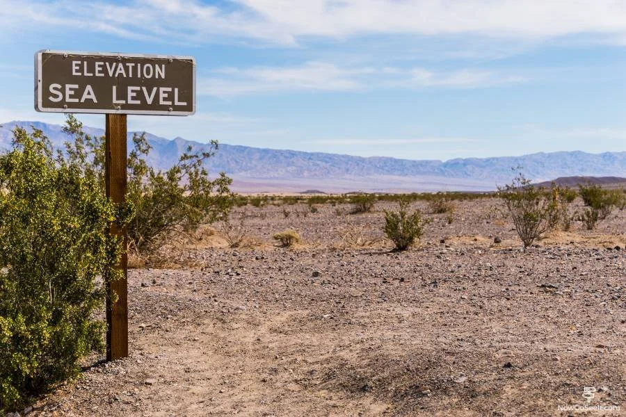
Death Valley is the largest national park in the lower 48 and home to some of the most extreme landscapes in the country. Whether you're planning a full Death Valley 2 day itinerary or just a day trip to Death Valley, this place delivers dry heat, salt flats, and serious isolation.
The largest national park in the continental United States sits on the border of California and Nevada.
Temperatures in Death Valley can get up to 120°F (49°C). Be sure to follow advice for travelers on the National Park Service website. Bring water and be alert for feuding roadrunners and coyotes.
We booked one night at the Longstreet Inn and Casino just east of the California-Nevada state line. If we had it to do over, we would stay in the Furnace Creek area instead. Our plan explores the northern part of the park on day one and the southern part on day two.
Death Valley By Car Itinerary
The LA to Death Valley road trip takes about 4 to 5 hours depending on your route, and the real adventure starts once you cross into the park. Day one of your Death Valley itinerary covers massive elevation drops, unique geology, and some of the best stops on any Death Valley road trip.
Day One: LA to Death Valley
From our place in Los Angeles, we hit the road at about 7 am, landing at the park border at about 10:30 am. The drive should take you between 3-3.5 hours from Los Angeles. There’s not much to see once you leave the LA Metro Area, so you can power through the drive fairly easily.
There’s no fanfare when you enter the park via State Route 190, you won’t find a traditional park entrance gate charging for park admissions. There is a fee required for entrance which must be paid at one of the fee machines or ranger stations further down the road.
Day One, Stop One: Father Crowley Point
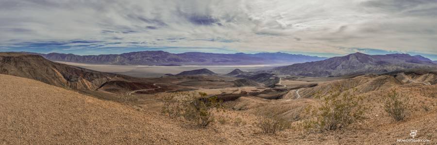
Father Crowley Point gives you your first wide-open view of the park and a chance to see fighter jets doing practice runs through Rainbow Canyon. It’s a great kick-off to any Death Valley National Park itinerary, especially if you’re coming in from the west.
After about six miles pull into the parking area for Father Crowley Point. A very short trail leads to a viewpoint of Rainbow Canyon, named for its walls of reds, grey, and pink created by mineral deposits. If you’re extremely lucky you might see an Air Force combat flight whiz by. this area is used for flight training.
Continue on 190 for about 45 minutes. After winding down the mountain to Panamint Springs (gas up if you need to). The road begins to straighten out. Continue to Stovepipe Wells.
Day One, Stop Two: Stovepipe Wells Ranger Station (Pay fees)
Make your stop at Stovepipe Wells Ranger Station to officially pay the park fee and pick up a map. This is your best shot to stock up before going deeper into the park, especially if you're doing a Death Valley 2 day itinerary without doubling back.
Visit the Stovepipe Wells ranger station to pay the admission for your visit. The $30 fee gets you one week in the park. Grab something for lunch at the General Store.

Day One, Stop Three: Hike Mosaic Canyon
Mosaic Canyon is a short but worthwhile hike through polished marble narrows and tight rock passages. It’s a standout hike for a Death Valley day trip from Vegas or part of a full Death Valley road trip from California.
Double back briefly and take the gravel road toward Mosaic Canyon. The full hike is about 4 miles and takes 2-3 hours. We’ll be only walking about one mile until a pile of boulders blocks the trail--about 45 minutes in and back. Mosaic Canyon was formed by frequent flash flooding. Watch for the canyon’s namesake natural mosaic, small pointed rocks in a natural cement polished smooth by erosion. Once you hit the giant boulders in the trail, turn back and head toward your car.

Day One, Stop Four: Climb the Sand Dunes at Mesquite Flat
The Mesquite Flat Sand Dunes are a choose-your-own-adventure climb—no trail, just sand and heat. If you’re looking to feel like you’re on another planet, this is one of the top picks on any day trip Death Valley list.
Take the gravel road back to 190 and drive the short distance to Mesquite Flat Sand Dunes. Here giant sand dunes rippled by the gusting wind engender the desert cliches we have always known. You can park and explore the dunes on foot. It’s a hell of a workout climbing to the top of one of these suckers.
Once you’ve been exhausted by the sand climbing fun, hop back into the car and travel on 190 turning left on Scotty’s Castle Road.
Day One, Stop Five: Scotty’s Castle
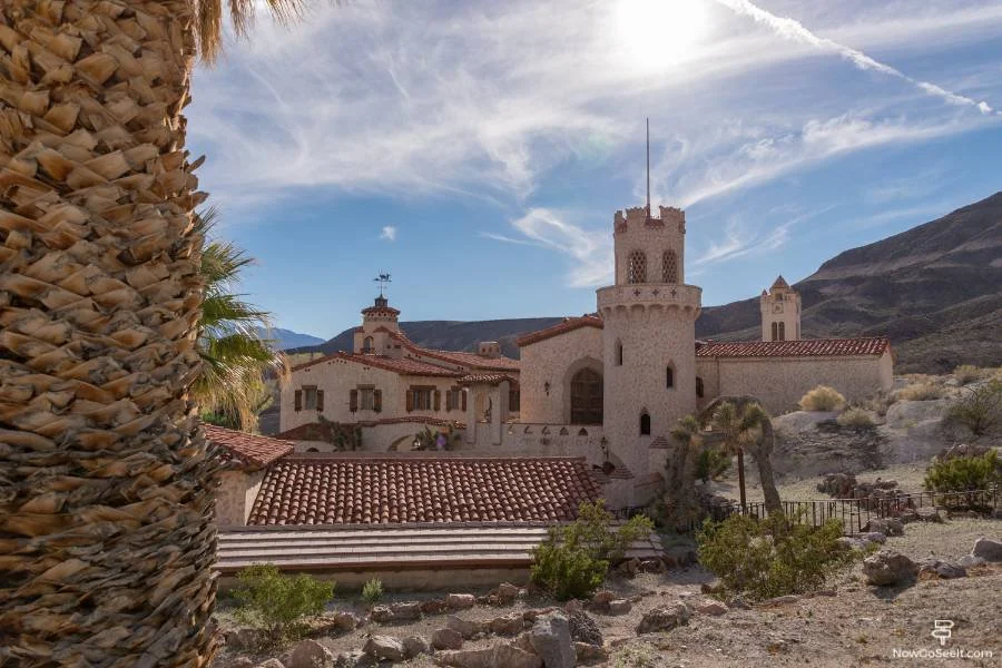
Scotty’s Castle is still closed for repairs, but the drive up gives you a sense of how isolated the place really is. Even if you can’t go inside, it’s a cool detour on a Death Valley 2 day itinerary if you're heading toward the northern part of the park.
We were fortunate to have been able to explore Scotty’s Castle. The Castle, which is an elaborate mission revival-style ranch home, was heavily damaged by flooding shortly after our visit. Repairs are expected to take as long as ten years. Currently (Fall 2023) tours are occasionally available, check the national park website for details.
Day One, Stop Six: Ubehebe Crater
Ubehebe Crater is a massive volcanic pit you can walk around the rim of or hike down into if you don’t mind the uphill return. It’s a late-day stop on your Death Valley road trip that’s usually less crowded and cooler than the valley floor.
Keep left onto Ubehebe Crater Road until hitting the crater. The crater is a whopping 600 feet deep and half a mile across. Park and walk along the crater edge for as long as you would like. The walk around the entire circumference is 1.5 miles. The crater was formed by an explosion of steam and gas when rising magma hit the groundwater, possibly as recently as 300 years ago.

Turn back out and head down Ubehebe Crater Road to Scotty’s Castle Road. Follow the road until meeting back up with 190, staying straight toward Beatty Junction and on to Salt Creek.
Day One, Stop Seven: Salt Creek
Salt Creek is home to the rare Devils Hole pupfish and an easy boardwalk loop worth doing if you're passing through. It's one of the few water-based stops in any Death Valley one day itinerary, and good for stretching your legs without much effort.
Park at Salt Creek and take the short Salt Creek Interpretive Trail. The drive should take about an hour from Ubehebe Crater.
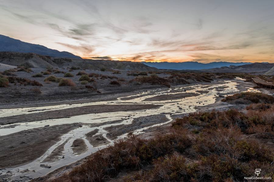
Where we stand was once the floor of a giant saltwater lake. Signs along the boardwalk trail tell you all about the unique ecosystem below your feet. You’ll also learn about the Devils Hole pupfish. This is the only place in the world where the critically endangered fish species live.

Day One: Return to Hotel
From there we drove another hour, outside of the park and across the Nevada state line to our hotel. Shortly after Salt Creek on 190, you’ll pass through Furnace Creek. Here there are some dining and lodging choices that would have been much more conveniently located.
We arrived at the hotel at about 8 pm, grabbed some dinner at the hotel restaurant, and went to bed early, exhausted from our day and excited for another day of exploration. Jump to Day Two in Death Valley.
Death Valley Road Trip Map
A printed map or downloaded offline version is essential—cell service disappears fast and Google Maps isn’t always helpful. Plan ahead if you're piecing together a custom Death Valley National Park itinerary or mapping out a Death Valley road trip from Las Vegas.


Grand Teton National Park is located just ten miles south of its famous sister, Yellowstone, making it an easy add-on to a trip to the nearby geothermal paradise.